2007年7月26日星期四
2007年7月15日星期日

2007年7月9日星期一
界石之謎﹝三﹞
現時香港法例﹝The Laws of Hong Kong﹞已沒有 1903 年維多利亞市界線條例,但釋義及通則條例﹝Interpretation and General Clauses Ordinance﹞的附表1﹝Schedule 1﹞,仍載有維多利亞市界線的定義,且於 1998 年才作過修訂﹝英語原文照錄如下﹞:
On the north - The Harbour;
On the west - A line running due north and south drawn through the north-west angle of Inland Lot No. 1299 and extending southwards a distance of 850 feet from the aforesaid angle;
On the south - A line running due east from the southern extremity of the western boundary until it meets a contour in the vicinity of the Hill above Belchers 700 feet above principal datum, that is to say, a level 17.833 feet below the bench-mark known as "Rifleman's Bolt", the highest point of a copper bolt set horizontally in the east wall of the Royal Navy Office and Mess Block Naval Dockyard, and thence following the said contour until it meets the eastern boundary;
On the east - A line following the west side of the Government Pier, Bay View and thence along the west side of Hing Fat Street, then along the north side of Causeway Road to Moreton Terrace. Thence along the west side of Moreton Terrace to the south-east corner of Inland Lot No. 1580 and produced in a straight line for 80 feet, and thence along the north side of Cotton Path and produced until it meets the west side of Wong Nei Chong Road on the east side of Wong Nei Chong Valley and thence to the south-east angle of Inland Lot No. 1364, produced until it meets the southern boundary.
將之與 1903 年的版本作一比較,可見兩者予東、南兩界的定義,不單在字面上大相徑庭, 1998 年的版本所述的東界,還包括「政府碼頭西邊,興發街西邊,高士威道北邊至摩頓台」﹝在上文以粗字示之﹞,似乎這一段界線在 1903 年的版本是沒有的。
※ ※ ※
後記:
從土地註冊處 1977 及 1987 年版的【港島、九龍及新九龍的街道、樓宇門牌號數和地段索引】找到以下資料:
On the north - The Harbour;
On the west - A line running due north and south drawn through the north-west angle of Inland Lot No. 1299 and extending southwards a distance of 850 feet from the aforesaid angle;
On the south - A line running due east from the southern extremity of the western boundary until it meets a contour in the vicinity of the Hill above Belchers 700 feet above principal datum, that is to say, a level 17.833 feet below the bench-mark known as "Rifleman's Bolt", the highest point of a copper bolt set horizontally in the east wall of the Royal Navy Office and Mess Block Naval Dockyard, and thence following the said contour until it meets the eastern boundary;
On the east - A line following the west side of the Government Pier, Bay View and thence along the west side of Hing Fat Street, then along the north side of Causeway Road to Moreton Terrace. Thence along the west side of Moreton Terrace to the south-east corner of Inland Lot No. 1580 and produced in a straight line for 80 feet, and thence along the north side of Cotton Path and produced until it meets the west side of Wong Nei Chong Road on the east side of Wong Nei Chong Valley and thence to the south-east angle of Inland Lot No. 1364, produced until it meets the southern boundary.
將之與 1903 年的版本作一比較,可見兩者予東、南兩界的定義,不單在字面上大相徑庭, 1998 年的版本所述的東界,還包括「政府碼頭西邊,興發街西邊,高士威道北邊至摩頓台」﹝在上文以粗字示之﹞,似乎這一段界線在 1903 年的版本是沒有的。
後記:
從土地註冊處 1977 及 1987 年版的【港島、九龍及新九龍的街道、樓宇門牌號數和地段索引】找到以下資料:
- 內地段 1580 號﹝Inland Lot No.1580﹞為摩頓臺 1、2、3、7、9 號,銅鑼灣道 19-41 號及信德街 19-21 號間的地方。
2007年7月6日星期五
界石之謎﹝二﹞
1903 年 11 月 20 日的香港轅門報,詳錄了 1903 年維多利亞市界線條例的全文,條例對維多利亞市的界線作出以下定義﹝英文原文照錄如下﹞:
On the North. - The Harbour.
On the West. - A line running north and south drawn through the north-west angle of Inland Lot No.1299 and extending southwards a distance of eight hundred and fifty feet from the aforesaid angle.
On the South. - A line running east from the southern extremity of the western boundary until it meets a contour of the hill-side seven hundred feet above the level known as Ordnance datum thence following the said contour until it meets the eastern boundary.
On the East. - A line following the western boundary of the Queen's Recreation Ground until it meets the old Shaukiwan Road, thence to the south-east angle of Inland Lot No.1018, thence along the southern boundary of Inland Lot No.1018, produced until it meets the road on the east side of Wongneichung Valley, thence to the north-west angle of Wongneichung School, produced until it meets the southern boundary.
當中隻字未有提及「 CITY BOUNDARY 1903 」界石。找遍隨後數年的立法局會議記錄、香港轅門報、 Hong Kong Blue Book 等官方文獻,亦不見一鱗半爪。另一方面,界線的定義涉及不少現時已鮮為人知的地標﹝以粗字示之﹞。
筆者在 1898 年 7 月 25 日的立法局會議記錄中找到以下一段文字,雖然這段文字亦有不少地方令筆者一頭霧水,但可推斷「 Queen's Recreation Ground 」可能就是現今浣紗街明渠以西至摩頓臺﹝包括中央圖書館、銅鑼灣運動場及中華樂會﹞的一幅康樂用地:
"That in commemoration of the completion of the sixtieth year of Her Majesty's Reign the piece of ground in question, situate at Causeway Bay, bounded on the north by the Causeway Bay Road, on the south and west by the Quarry Bay Road and Inland Lot 1,149 (Kennedy's Stables), and on the east by the Nullah, running from the Quarry Bay Road to the Causeway Road, may be by Ordinance reserved as a public and open space for ever, may be called the 'Queen's Recreation Ground' and may, under Regulations to be embodied in the Ordinance, be dedicated to the purposes of general public recreation for all nationalities."
此外,據悉銅鑼灣道﹝Tung Lo Wan Road﹞及英皇道﹝King's Road﹞都是筲箕灣道的一部分,直至 1935 年,銅鑼灣的一段才改稱銅鑼灣道。相信東界的定義內所指的「舊筲箕灣道」﹝old Shaukiwan Road﹞,可能接近現今的銅鑼灣道﹝但在 1903 年,所謂「舊」是指什麼?﹞
筆者另於 1911 年 8 月 24 日的立法局會議記錄中找到以下一段:
"THE ATTORNEY-GENERAL -- On clause 39B in the Colonial definitions page 7 the eastern boundary of the city of Victoria mentioned in the last line but one refers to the north-west angle of the Wongneiche[gon/ong] School. That is not a permanent landmark. As a matter of fact it has almost disappeared, so I would suggest that the words 'the south-east angle of inland lot No.1,364' be substituted for the words 'north-west angle of the Wongneicheong School.'
This was agreed to."
從中可以知道,維多利亞市界線條例曾於 1911 年經過修訂,東界定義中提到的「黃泥涌學校」﹝Wongneichung School﹞已被另一地標 ── 內地段 1364 ﹝inland lot No.1364﹞── 取代。
※ ※ ※
後記:
從土地註冊處 1977 及 1987 年版的【港島、九龍及新九龍的街道、樓宇門牌號數和地段索引】找到以下資料:
On the North. - The Harbour.
On the West. - A line running north and south drawn through the north-west angle of Inland Lot No.1299 and extending southwards a distance of eight hundred and fifty feet from the aforesaid angle.
On the South. - A line running east from the southern extremity of the western boundary until it meets a contour of the hill-side seven hundred feet above the level known as Ordnance datum thence following the said contour until it meets the eastern boundary.
On the East. - A line following the western boundary of the Queen's Recreation Ground until it meets the old Shaukiwan Road, thence to the south-east angle of Inland Lot No.1018, thence along the southern boundary of Inland Lot No.1018, produced until it meets the road on the east side of Wongneichung Valley, thence to the north-west angle of Wongneichung School, produced until it meets the southern boundary.
當中隻字未有提及「 CITY BOUNDARY 1903 」界石。找遍隨後數年的立法局會議記錄、香港轅門報、 Hong Kong Blue Book 等官方文獻,亦不見一鱗半爪。另一方面,界線的定義涉及不少現時已鮮為人知的地標﹝以粗字示之﹞。
筆者在 1898 年 7 月 25 日的立法局會議記錄中找到以下一段文字,雖然這段文字亦有不少地方令筆者一頭霧水,但可推斷「 Queen's Recreation Ground 」可能就是現今浣紗街明渠以西至摩頓臺﹝包括中央圖書館、銅鑼灣運動場及中華樂會﹞的一幅康樂用地:
"That in commemoration of the completion of the sixtieth year of Her Majesty's Reign the piece of ground in question, situate at Causeway Bay, bounded on the north by the Causeway Bay Road, on the south and west by the Quarry Bay Road and Inland Lot 1,149 (Kennedy's Stables), and on the east by the Nullah, running from the Quarry Bay Road to the Causeway Road, may be by Ordinance reserved as a public and open space for ever, may be called the 'Queen's Recreation Ground' and may, under Regulations to be embodied in the Ordinance, be dedicated to the purposes of general public recreation for all nationalities."
此外,據悉銅鑼灣道﹝Tung Lo Wan Road﹞及英皇道﹝King's Road﹞都是筲箕灣道的一部分,直至 1935 年,銅鑼灣的一段才改稱銅鑼灣道。相信東界的定義內所指的「舊筲箕灣道」﹝old Shaukiwan Road﹞,可能接近現今的銅鑼灣道﹝但在 1903 年,所謂「舊」是指什麼?﹞
筆者另於 1911 年 8 月 24 日的立法局會議記錄中找到以下一段:
"THE ATTORNEY-GENERAL -- On clause 39B in the Colonial definitions page 7 the eastern boundary of the city of Victoria mentioned in the last line but one refers to the north-west angle of the Wongneiche[gon/ong] School. That is not a permanent landmark. As a matter of fact it has almost disappeared, so I would suggest that the words 'the south-east angle of inland lot No.1,364' be substituted for the words 'north-west angle of the Wongneicheong School.'
This was agreed to."
從中可以知道,維多利亞市界線條例曾於 1911 年經過修訂,東界定義中提到的「黃泥涌學校」﹝Wongneichung School﹞已被另一地標 ── 內地段 1364 ﹝inland lot No.1364﹞── 取代。
後記:
從土地註冊處 1977 及 1987 年版的【港島、九龍及新九龍的街道、樓宇門牌號數和地段索引】找到以下資料:
- 內地段 1299 號﹝Inland Lot No.1299﹞為域多利道 60 號﹝不見於 1987 年版的【索引】﹞。
- 內地段 1018 號﹝Inland Lot No.1018﹞為聖保祿學校及聖保祿醫院新翼所在地。
- 內地段 1149 號﹝Inland Lot No.1149﹞為摩頓臺 1-15 號,銅鑼灣道 3-17 號及高士威道 2-36 號﹝摩頓臺﹞之間的地方。
- 內地段 1364 號﹝Inland Lot No.1364﹞為摩頓臺 1、2、3、7、9 號,銅鑼灣道 19-41 號及信德街 19-21 號之間的地方。
2007年7月4日星期三
界石之謎﹝一﹞
初中時用的世界地圖集還在,附頁列有世界各國的首都名字:
Hong Kong ── Victoria
香港當然不是「國」,但除英女皇、海港及公園之外,原來「維多利亞」亦是香港「首都」的名字。早於 1843 年,香港政府已稱當時的市區為「維多利亞市」,但沒有為維多利亞市定下清清晰的界線。1903 年 10 月 1 日,當時的律政司﹝Attorney-General﹞Sir Henry S.Berkeley 在立法局動議立法為維多利亞市劃界,同年11月19日,有關法案在立法局三讀通過,1903年維多利亞市界線條例﹝The City of Victoria Boundaries Ordinance, 1903﹞正式生效,遂於翌日透過香港轅門報﹝Government Gazette,等同於現今的憲報﹞將條例的全文公告天下。
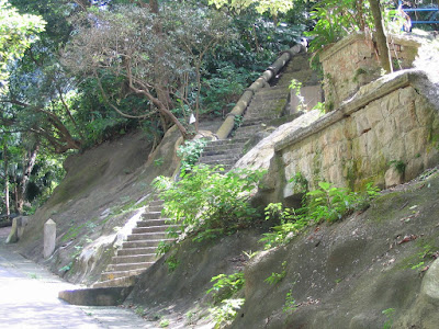
為標誌界線,政府在界線上多處地方豎立了刻有「CITY BOUNDARY 1903」的界石。一個世紀過去了,至少有六柱界石尚存於世,分別位於:
1. 堅尼地城海傍,西寧街球場內;
2. 薄扶林道近摩星嶺道交界,往南區方向的行人路上﹝行人隧道入口傍﹞;
3. 克頓道,距旭龢道交界約半公里;
4. 舊山頂道近地利根德里;
5. 寶雲道,距司徒拔道交界約半公里;
6. 黃泥涌道聖保祿小學對面行人路上。

去年有人於馬己仙峽道 15 號附近﹝243 號郵筒後﹞找到一柱疑是維多利亞市的界石,半埋於斜坡護土牆內;不消數月這柱石己消失得渺無影踪,很可能是修葺斜坡護土牆時被拔掉。究竟這是否另一柱維多利亞市界石?當初政府共豎立了多少柱界石?還有沒有其他界石未被發現?全都是──謎。
Hong Kong ── Victoria
香港當然不是「國」,但除英女皇、海港及公園之外,原來「維多利亞」亦是香港「首都」的名字。早於 1843 年,香港政府已稱當時的市區為「維多利亞市」,但沒有為維多利亞市定下清清晰的界線。1903 年 10 月 1 日,當時的律政司﹝Attorney-General﹞Sir Henry S.Berkeley 在立法局動議立法為維多利亞市劃界,同年11月19日,有關法案在立法局三讀通過,1903年維多利亞市界線條例﹝The City of Victoria Boundaries Ordinance, 1903﹞正式生效,遂於翌日透過香港轅門報﹝Government Gazette,等同於現今的憲報﹞將條例的全文公告天下。
為標誌界線,政府在界線上多處地方豎立了刻有「CITY BOUNDARY 1903」的界石。一個世紀過去了,至少有六柱界石尚存於世,分別位於:
1. 堅尼地城海傍,西寧街球場內;
2. 薄扶林道近摩星嶺道交界,往南區方向的行人路上﹝行人隧道入口傍﹞;
3. 克頓道,距旭龢道交界約半公里;
4. 舊山頂道近地利根德里;
5. 寶雲道,距司徒拔道交界約半公里;
6. 黃泥涌道聖保祿小學對面行人路上。
去年有人於馬己仙峽道 15 號附近﹝243 號郵筒後﹞找到一柱疑是維多利亞市的界石,半埋於斜坡護土牆內;不消數月這柱石己消失得渺無影踪,很可能是修葺斜坡護土牆時被拔掉。究竟這是否另一柱維多利亞市界石?當初政府共豎立了多少柱界石?還有沒有其他界石未被發現?全都是──謎。
訂閱:
文章 (Atom)